XE Explains: Orange Sahara dust blankets Europe and the UK

Extraordinary sights of the sky were painted in vivid colours of yellow, orange, pink and red hues covering Europe and the UK this week! What is it? Where did it come from? What does it mean for our current climate? Professor Richard Washington teaches Climate Science at the University of Oxford and is Head of Extreme E’s Scientific Committee explains.
Extreme E: Why are we seeing such yellow and orange clouding our skies over Europe and the UK?
Professor Richard Washington: The colours we have seen reigning over our skies has been caused by Sahara Dust blowing in from a storm across the Mediterranean Sea, composed of a mix of both sand and dust by strong winds from the Sahara Desert, located in North Africa.
XE: The biggest question remains; how does this dust affect our planet and current climate?
RW: Dust is an important part of the earth system, including climate. During the day, the sun reflects off the dust and cools the atmosphere whilst during the night, it tends to warm the atmosphere. However, dust can also work like a greenhouse gas by absorbing heat radiated from the earth, causing warming. Exactly whether the overall effect is one of warming or cooling depends on all sorts of things like the size of the dust particle, the height of the dust and its size, shape and colour.
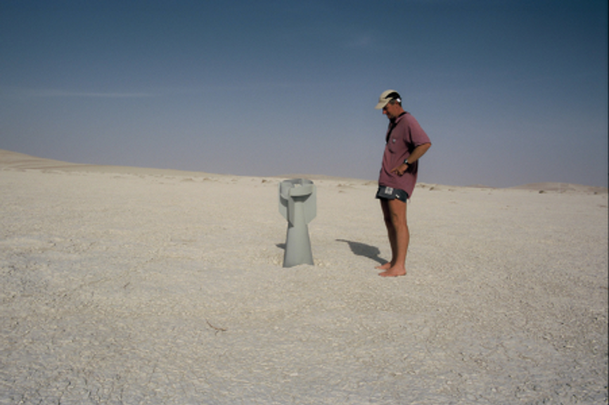
Dust also influences clouds and can affect the development of weather systems like tropical cyclones. The components of dust also fertilise the oceans and land areas like the Amazon Forest. This usually occurs during the winter where dust from the Bodele in Chad – where I was fortunate to take part in the first experiment to measure winds and dust in the world’s largest single dust source - crosses the Atlantic and is especially beneficial to the Amazon Forest as it lacks certain nutrients which the dust clouds help to facilitate, assisting the environment to thrive.
XE: How far it has travelled so far?
RW: The Sahara Dust storm has travelled over 3000km to the UK from the Sahara Desert where it originated in Algeria. As you can see from the Met Office below, the pink is the dust and the red is the deep clouds.
We can see the #SaharanDust that has pushed across Spain and France, into southeast England
— Met Office (@metoffice) March 16, 2022
Whilst this #dust is mostly about 2km above ground level, some deposits may fall to the ground, especially during today's rain in southern parts of the UK pic.twitter.com/9mxfcnk8cv
XE: An unusual sight, but exactly how common are these dust storms blowing in from the Sahara?
RW: In the Sahara Desert, it happens more often than you think, taking place every second day as dust is easily lifted by the wind. The peak season is mid-summer and covers an incredibly large area travelling over Algeria, Mali, Niger and Mauritania. However, in the UK, this type of dust storm occurs two to three times a year that is noticeable and traceable, typically in the Spring time.
XE: Interesting, could you explain in more detail what causes these dust storms?
RW: Generally, what causes dust storms over the Sahara in the summer are from winds resulting from the bottom of thunderstorms. The bottom of storms is usually 5km above the surface (typically 1-2 km in England) and the air under the storm is super dry. Almost all of the rain (over tens of thousands of tonnes of rain recorded) evaporates into the dry air. This cools the air, essentially creating a massive plug of dense air which blows across the desert surface, raising and carrying dust as it goes. That dust can cover 800km across the desert surface and can stay in the air for many days.
On this occasion, this Sahara dust blanket was caused by Storm Celia over Africa, specifically Algeria and Morocco. This strong low-pressure system which typically causes more turbulent weather guided the winds and dust storm towards the Mediterranean, entering into Spain and across France into southeast England. Monday 14 March was recorded as the heaviest of all in terms of dust coverage.

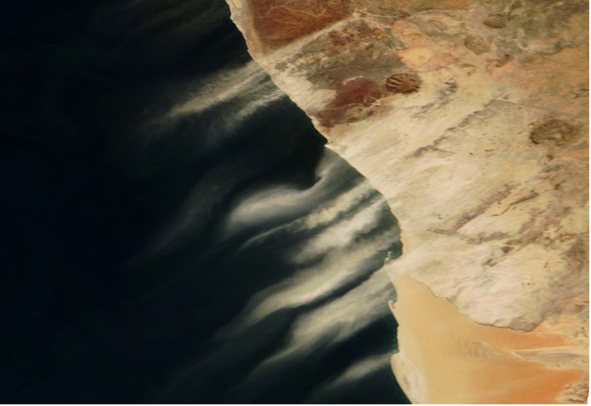
Example of how dust blows taken from the Namib desert into the South East Atlantic
Temperatures are usually higher in locations with larger dust coverage and much cooler as the dust spreads and dispersed. For this dust storm, this is the present situation in Spain where high temperatures have been recorded and is currently under a state of emergency, residents are warned not to venture outdoors. If so, as reported by the Spanish emergency authorities, wearing face masks are recommended due to poor breathable air quality. Dust storms are a major problem for transport, particularly aviation which is also occurring for the Canary and Balearic Islands due to no visibility and high winds.
XE: How do you track dust?
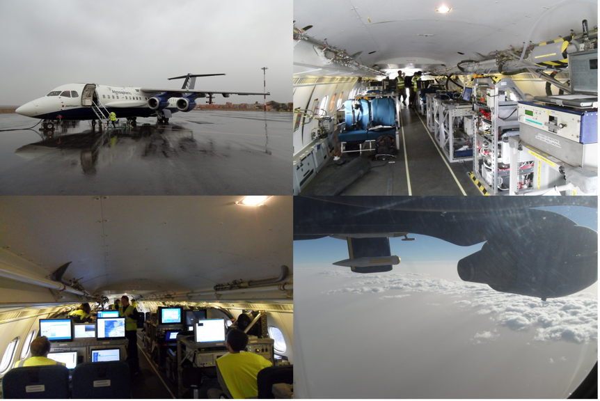
RW: Dust storms are tracked via satellite and scanners examining both wind currents and weather forecasts. I have travelled on several campaigns to gather data to understand dust, one of which was Fennec. In this, we boarded a Bae-146 aircraft which flew for 200 hours over the Sahara where the team measured dust particles to understand their size, shape and concentration. We were able to measure dust particles about 1mm in diameter and 3km above the surface, however we do not know of the physics that can explain this.

Fennec campaign: collecting dust particle data on Bae-146 aircraft for 200 hours over the Sahara
Also, the weather forecast equipment underestimates tracking the dust as the dust heats the atmosphere almost 10 times more than the weather forecasts predicts. In short, there is a lot we still do not know about dust despite several campaigns to measure it.
XE: In your experience, how have dust storms changed during the time of your studies?
RW: Over the past 50 years, I have noticed a significant change in the sources of dust, from predominantly natural sources to now including more humanly caused sources, as a result of desertification.

Professor Richard Washington on the ground in Bodele Depression, Chad